

At some of the locations on this page you will find the Geocaching symbol which means that there is a Geocache hidden nearby.
Geocaching is a fun treasure hunting game for the whole family. Participants navigate to a specific set of GPS coordinates using a smartphone or a GPS device and then attempt to find a treasure hidden at that location. Finds can be logged online. Register a free account and start searching!
For more information visit the Geocaching website.
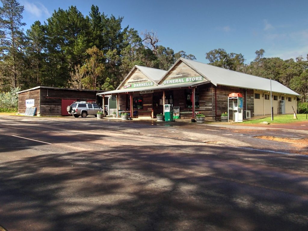
Darnell's General Store Witchcliffe
Redgate Road, Rosa Brook
Darnell’s Store in Witchcliffe was originally built by Tom Hopson “who travelled in from the mill (East Witchcliffe) each day as he built the hall and shop, but no living quarters’. The second owners were Mr and Mrs Fearn, who took over the store after Hopson’s death, “with Mrs Fearn running the shop while Mr Fearn ran their farm at Witchcliffe.” In 1938, Bill Darnell and George Shervington bought the store in Rosa Brook and Shervington running the new Witchcliffe one. With the death of Shervington, Darnell changed over to run Witchcliffe, leaving his son Bill, to run the Rosa Brook store.
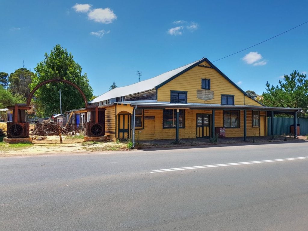
"Druids" Hall Witchcliffe
Bussell Highway, Rosa Brook
The hall was originally erected by the Samworth family as a shop to service the group settlers who were in the process of developing farms in the area. By the early 1940s it had become too small. The hall was then utilised for living accommodation in the early 1940s. the Druid’s Lodge bought the building in 1945 (28th May) and stayed there until it was given to the Shire Council.
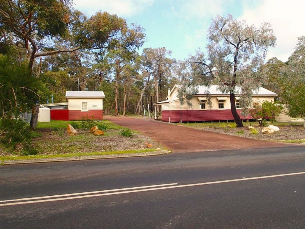
CWA Hall Witchcliffe
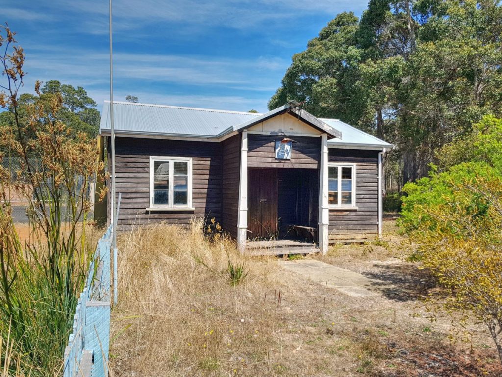
Redgate Road, Rosa Brook
The Witchcliffe CWA commenced in February 1933 and had raised enough money to erect their own hall by 1936. The hall is surrounded by a natural garden and a wood and paled fence. It is situated on the edge of the town.
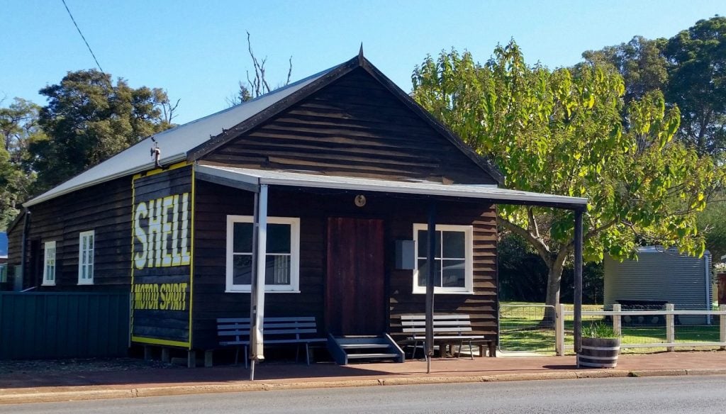
Darnell's General Store Rosa Brook
Rosa Brook Road, Rosa Brook
Darnell’s Store in Witchcliffe is in it’s original state, not only externally but internally as well. The store is set out and operated as is was in the 1930s, which gives its unique character and attracts many tourists. Even though it has this old fashioned character and charm, it is still being run as a successful business providing a general store and post office to the community.
Rosa Brook Community Hall
Rosa Brook Road, Rosa Brook
The hall originally opened as a school in 1925 to serve the local group settlement children. It was later used as a community hall and extend to include kitchen facilities and a stage. The hall is frequently used by sporting groups, playground, the CWA and in addition, many social functions are held over there during the year.
CWA Hall Rosa Glen
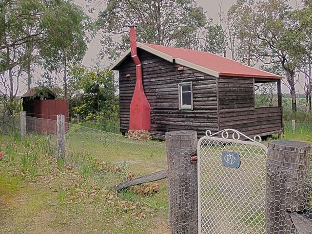
Cnr Rosa Glen Rd & Lucas Rd, Rosa Glen
Only the single teacher's quarters remains of the old school in Rosa Glen. The building is now used by the Country Women's Association.
Jarrahdene Timber Mill
Adjacent Jarrahdene campground
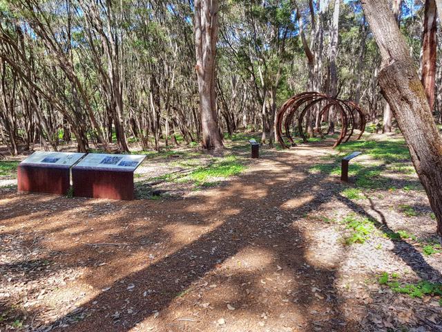 The Jarrahdene Timber Mill was the largest of four local mills established by MC Davies and operated between 1895 until 1913. This important site still retains significant evidence of the early timer industry in the area. Adjacent to the mill were several buildings including a general store, a workshop and the manager's residence. The settlement was located to the east of the mill and to the south was the school house and teacher's quarters.
The site is adjacent the Jarrahdene campground and is easily accessible through Jarrahdene Road, which is a well maintained gravel road. Interpretive signage can be found along the walkway with information about the mill and the early settlers who worked and lived in the settlement.
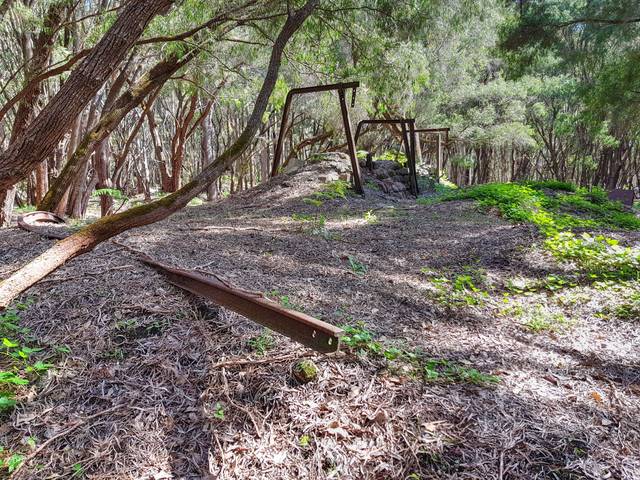
Boranup Timber Mill
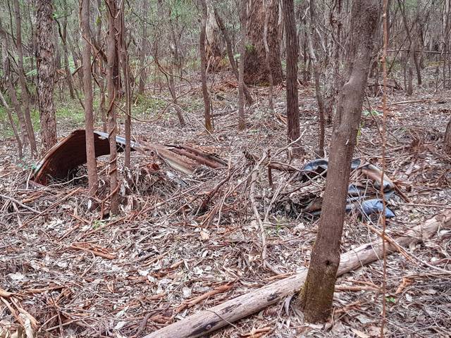
Near corner Anchor Road and Douglas Road
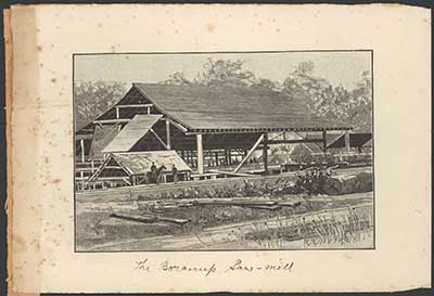
Boranup saw mill between 1870 and 1929
A.J. Campbell collection
The Boranup Mill was a major part of the Davies’ timber industry and included a private mill settlement containing houses, shops and other community amenities for the timber workers.
The original mill burnt down in 1891 but a new and more powerful mill had been completed by August of that year. In 1961, the Karridale fire destroyed almost all of what remained at the site of the old mill.
The site of the old Boranup Mill is now overgrown with mature native trees, with an open forest floor covered by heavy leaf litter. There are numerous mounds and depressions in the general area, but the leaf litter has concealed evidence of the nature of these formations or of any associated built elements. As part of the visual survey undertaken in February 2012, the concrete foundation identified in the 1997 archaeological survey was not located, but a collapsed corrugated iron structure (possibly a rainwater tank) and a pile of collapsed brickwork were identified. There are also linear epressions, which may relate to former snig tracks.
Karridale Timber Mill
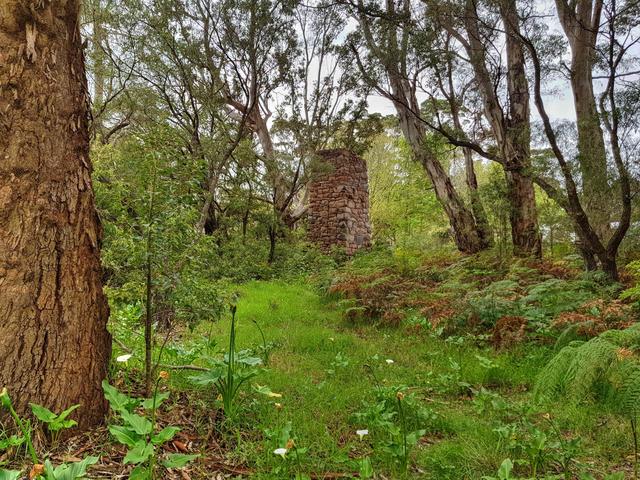
Near Karridale Close
Exact coordinates: 34°12'52.4"S 115°04'30.6"E
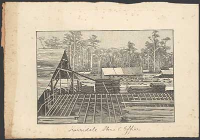
Karridale store and office between 1870 and 1929
A.J. Campbell collection
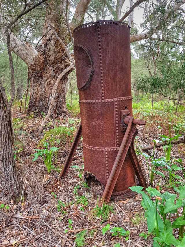 The Coodardup mill was moved to Karridale in early 1882 and increased to double the capacity. Over the next twenty years a self-contained private mill town was developed to accommodate the timber workers.
The Karridale mill closed in c1905 and a number of buildings and materials were subsequently removed from the site, as was common practice.
In 1961, bush fires raged in many areas of Western Australia. On 3 March, the 60 Karridale residents were evacuated. The hall, post office and general store, St. Augustine's Church, and two houses were destroyed. The only remaining buildings in the town were the CWA Rest Room, and seven houses. At the former mill site, the stone foundry chimney was almost all that remained after the fire. The only other remains at the mill site were a boiler which stood horizontal, supported by sections of rail line, and a nearby brick oven. The town was never rebuilt.