
Introduction
In 2022 the Margaret River Historical Society undertook a site survey in Boranup Forest. The reason was an entry in The Shire of Augusta-Margaret River Heritage Inventory July 2012, pages 206-209, called Boranup Mill Site and Archaeological Remains.
In a survey in 1997 archaeologist Dr Shane Burke identified concrete machinery footings holding large iron bolts at the site but couldn't find more evidence of the existance of a mill or settlement as the site was covered in leaf litter. The Shire of Augusta Margaret River undertook a visual survey in February 2012. The concrete foundation identified in the 1997 archaeological survey was not located, but a collapsed corrugated iron structure (possibly a rainwater tank) and a pile of collapsed brickwork were identified. Also mentioned were linear depressions, which may relate to former snig tracks.
2022 Research
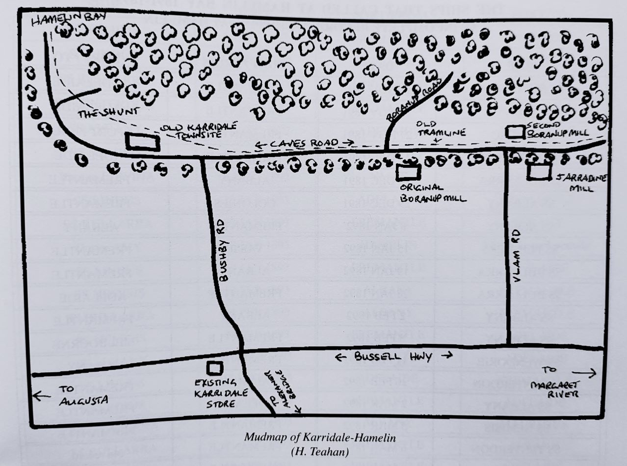
Mudmap of Karridale-Hamelin from the book "The Ghosts of Hamelin Bay" by Garry Teahan
Research in 2022 revealed that the original Boranup Mill was located at Arumvale, a few kilometers south of the site. The only evidence of another mill site in Boranup was found on a hand drawn mud map of Karridale-Hamelin by H. Teahan, identifying it as the second Boranup Mill.
2022 Site Survey
Because of a bushfire in December 2021 the site was cleared from leave litter and a site survey was undertaken in 2022 and 2023 by the Margaret River Historical Society. The concrete foundations found in the 1997 survey by archaeologist Dr Shane Burke were located. The iron structure and a pile of collapsed brickwork found in the 2012 Shire survey were also identified. A patch of Lachenalia ‘Soldier Boys’ flowers, another pile of bricks with a metal Peters ice-cream sign and a significant amount of artifacts were found. Next to the pile of bricks, a handmade antenna and a possible earth pin with wires still attached were found, indicating that the bricks could have been part of a chimney.
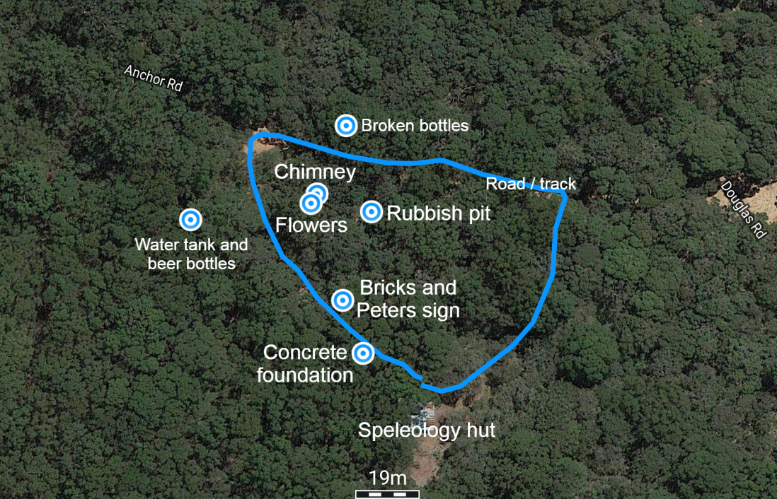
Site survey map 2022-2023 - Exact coordinates available at the Margaret River Historical Society
Site dating
The concrete foundations were identified as likely being used for a diesel generator. The bottles and household items were probably from the 1940's - 1960's. The handmade antenna and possible earth pin also indicate a date from the mid to late 20th century. The site was probably not related to the original Boranup Mill site at Arumvale as this one closed in 1910 but this site could have been a later mill site from around the mid-20th century.
Photo's 2022/2023 site survey


